Antique Maps & Prints of Natural History, Botanicals, & More
By Trillium Antique Prints & Rare Books
Contact Auction House
Jun 15, 2024
115 Hampsted Lane Franklin, TN 37069, United States
Terms of Sale
View Demo
|
LOT 63212:
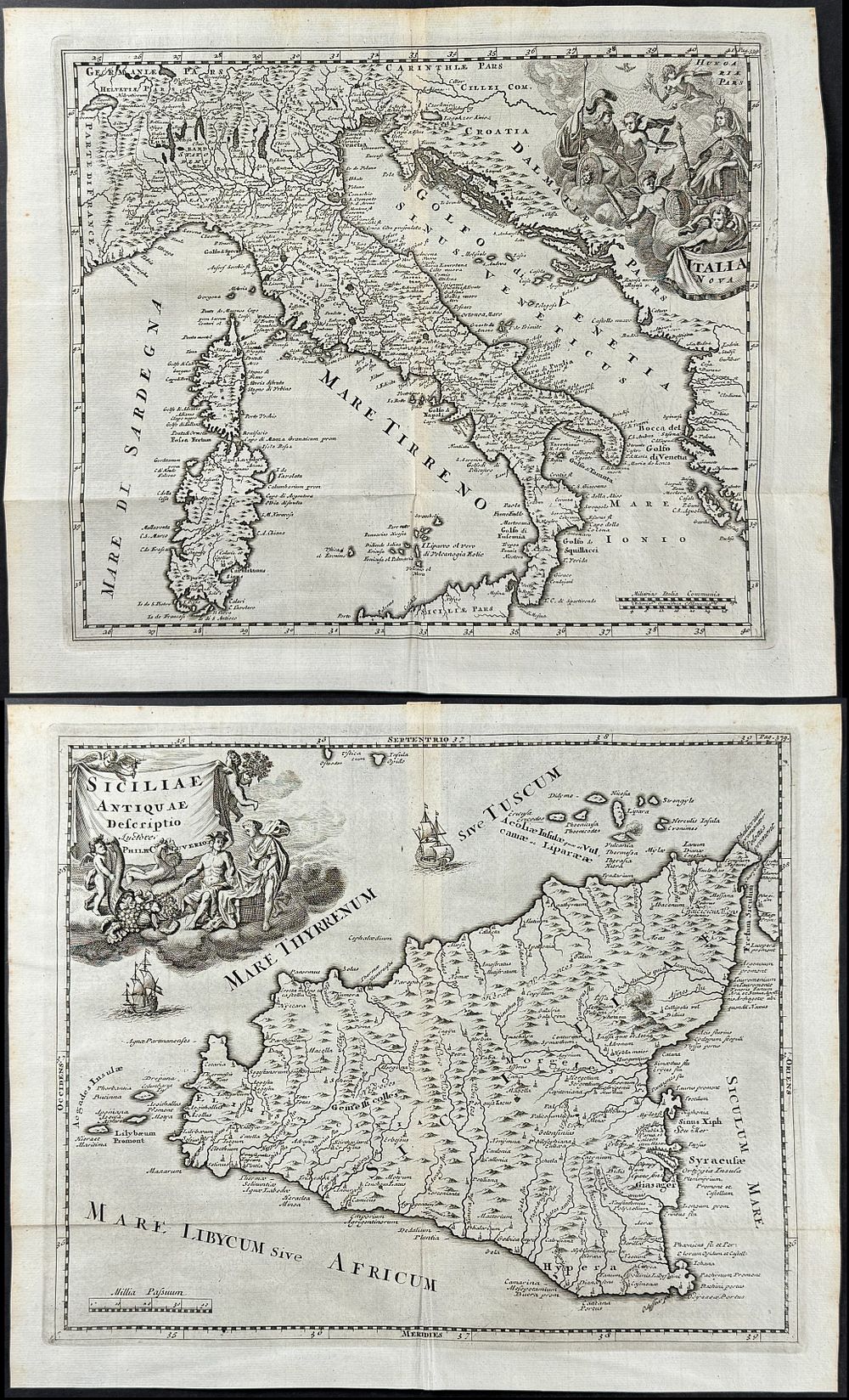
Cluver - 4 Maps of Italy & Sicily
more...
|
|


|
Sold for: $425
Price including buyer’s premium:
$
467.50
Start price:
$
75
Estimate :
$400 - $800
Buyer's Premium: 10%
More details
|
Cluver - 4 Maps of Italy & Sicily
This historic engraving is from Philipp Cluver's Introductionis in universam geographiam, tam veterem, quam novam libri VI. Praefixit A. Bruzen de la Martinière. The work was published by P. de Coup in Amsterdam in 1729. The was an expanded edition with maps from Guillaume De L'Isle. The work, first published 1624, was an important early study in Geography and became a standard text.
Philipp Cluver (Philippi Cluverius) (1580-1622) was a Polish / German geographer and historian. Cluver is considered the father of modern historical geography.
Paper Size ~ 14 1/4" by 12" (Fold Out); De L'Isle Map measures ~ 22 1/4" by 17 1/2" (Fold Out)
The work is in very good to excellent condition overall. There may be some faint offset to engravings from this work due to the fold out nature of the plate. There may be a few minor imperfections to be expected with age. Please review the image carefully for condition and contact us with any questions.
~ 14 1/4" by 12" (Fold Out); De L'Isle Map measures ~ 22 1/4" by 17 1/2" (Fold Out)
